Secteur d’activité
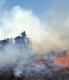
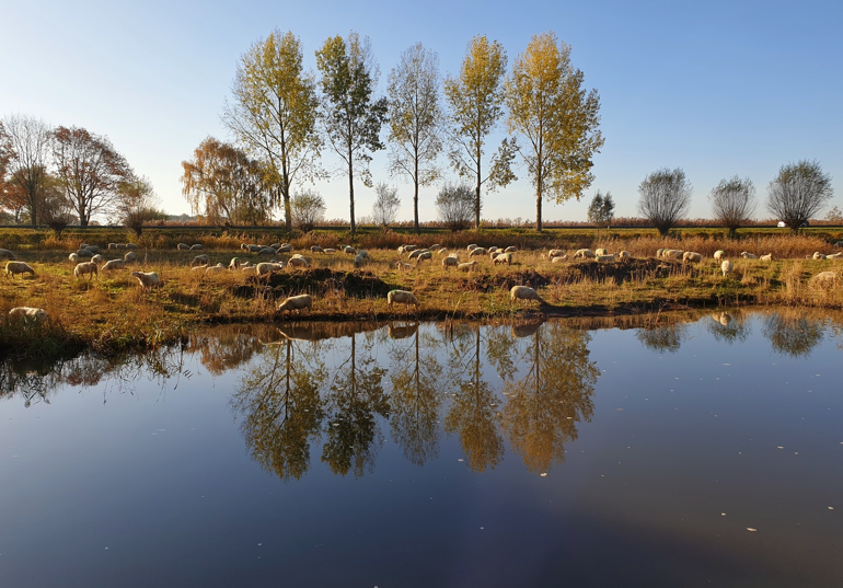
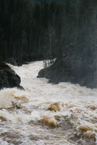
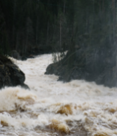
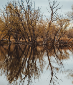
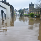
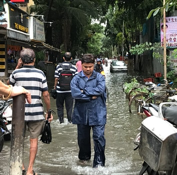
Les populations touchées par les crues et les inondations sont de plus en plus nombreuses, et les dégâts matériels associés de plus en plus couteux pour notre société. Mais le dérèglement climatique provoque également des étiages sévères qui raréfient la ressource en eau.
Comprendre, surveiller, mieux informer la population des risques d’inondation, acquérir des données et donc de la connaissance afin de réagir à temps, voilà les sujets sur lesquels PARATRONIC met au point des systèmes simples et efficaces, en étroite collaboration et en répondant aux exigences de professionnels aguerris dans la lutte contre ces différents fléaux.
En savoir plus sur les inondations
L’acquisition de données pluviométriques, limnimétriques, débitmétriques et physico-chimiques, la transmission en temps réel ou à pas de temps régulier en vue d’une centralisation des informations, le stockage des données et leur critique, la transmission d’alarmes, l’historisation des mesures et des évènements, l’échange de données inter-applications ou interservices, pour la prévision des crues ou la mutualisation des données hydrologiques, sont désormais les éléments incontournables pour la gestion de l’hydrologie, qu’il s’agisse de prévision des crues et des inondations ou de la gestion de la ressource en eau.
Face à la multiplication des solutions propriétaires qui se sont développées à travers les offres des différents constructeurs et l’incompatibilité des équipements d’origines différentes constitue le principal frein à l’évolution des systèmes existants. La multitude de protocoles de communication, les différents systèmes d’exploitation ainsi que la volonté de préserver des positions de monopole, poussent les constructeurs à fermer leurs systèmes.
Ces solutions sont alors inaptes à toute intégration dans de nouveaux schémas, autres que ceux maîtrisés par le fournisseur initial. Cette situation, très inconfortable pour les utilisateurs, conduit à une rigidité et surtout à des possibilités d’évolution très limitées qui rendent les systèmes rapidement obsolètes.
Notre offre s’inscrit dans une approche radicalement différente et garantit la pérennité de l’investissement.
PARATRONIC développe des logiciels Multi Protocoles afin d’accueillir dans le réseau de mesures des matériels existants, ou de permettre aux utilisateurs de réaliser des réseaux intégrant des matériels provenant de divers fournisseurs.
Les matériels PARATRONIC utilisent des protocoles ouverts et libres de droits, ce qui garantit une compatibilité avec tous les médias de transmission (radio, GSM, RTC, satellite…). L’utilisation d’interfaces en « client léger » autorisent l’utilisation de tous les types de machines et systèmes d’exploitation, sans limitation du nombre de postes clients (pas de licence limitant le nombre d’utilisateurs). L’universalité du langage de programmation autorise l’utilisation de tous les types de machines et de systèmes d’exploitation aussi divers que Windows ou Linux
Basé sur une station d’acquisition ultra faible consommation et un superviseur web (logiciel hébergé), la solution PARATRONIC vous permet de réaliser les mesures de niveau, pluviométrie, débit, qualité des eaux (température, pH…) et de disposer à tout moment de vos mesures sous forme de tableaux, graphiques ainsi que d’une représentation cartographique de votre réseau de mesures. Les alertes vous sont envoyées par SMS et mail.
Sans licence ni installation de logiciel, vous accédez à votre superviseur depuis n’importe quel terminal connecté à internet : Tablettes, PC, smartphones…
La solution de Superviseur web hébergé vous évite ainsi tout investissement informatique et vous libère des contraintes de maintenance des serveurs.
Qu’il s’agisse d’un système d’alerte local inondation, de surveillance hydrologique, de prévision des crues ou de surveillance de forages, vous accédez à votre cartographie et à vos données 24h/24 et 7j7.


Données en temps réel et présentation cartographique : le passage de la souris sur une station ouvre une « infobulle » présentant les dernières mesures transmises par la station.
Vous pouvez alors accéder au « statut instantané » de vos stations : dernières mesures réalisées, seuil d’alerte programmé, alerte en cours et aux photos ou vidéos transmises automatiquement par la station.
D’un simple clic vous accédez aux fonctions d’analyse et pouvez ainsi réaliser des tableaux, des graphiques (courbes et histogrammes) à partir de l’historique des mesures (3 ans de mesures stockés en base). Les données et graphiques peuvent alors être exportés : format csv (compatible Excel) pour les tableaux et pdf, jpeg, png, svg pour les graphiques.
Le menu de configuration vous permet de paramétrer les seuils d’alertes et de préalerte pour lesquels vous souhaitez recevoir des alarmes par mail et/ou SMS, ainsi que l’ordre dans lequel vous souhaitez que les différentes personnes soient alertées si l’alarme n’est pas acquittée.
Sur le terrain, la station LNS ultra faible consommation permet d’équiper des sites dépourvus d’énergie. En effet, la LNS consomme en moyenne moins de 1 mA et gère l’alimentation des capteurs, modems et caméra. Ainsi, la LNS peut accélérer la fréquence de mesures et/ou de transmissions lorsqu’un seuil est dépassé. Cette optimisation globale de la consommation du site permet donc d’équiper des sites autonomes en énergie.
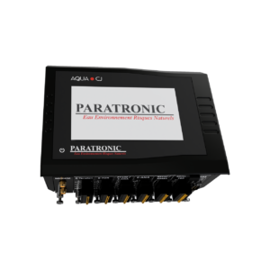
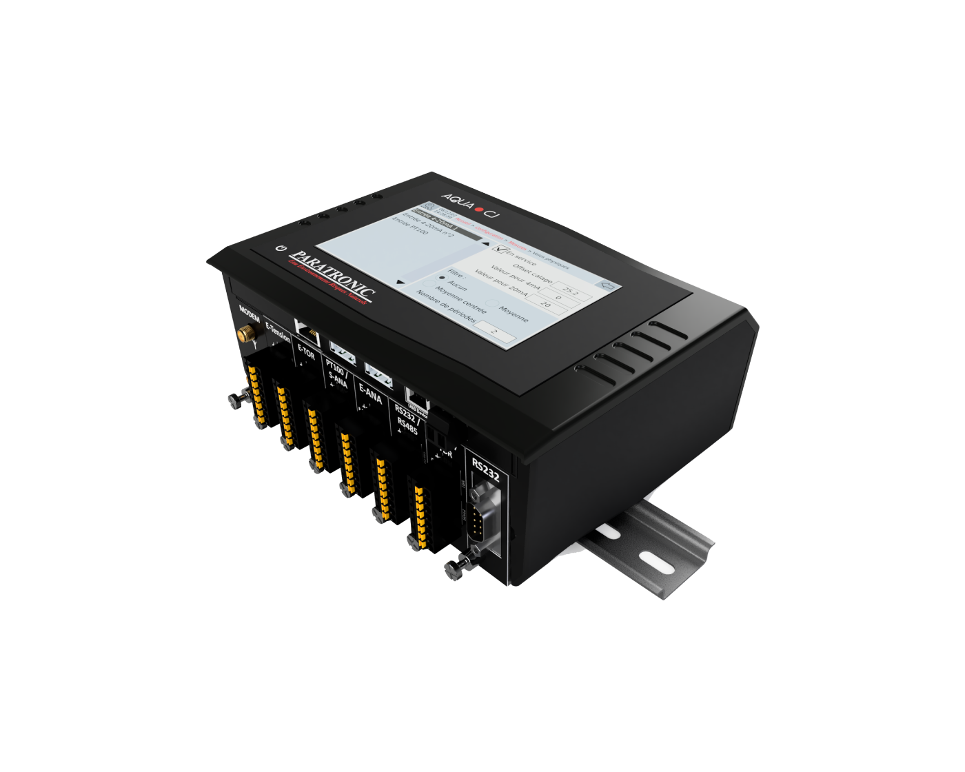
Toutes les équipes de PARATRONIC sont fières de vous annoncer la sortie de l’AQUA-CJ, nouvelle station modulaire, multi-protocole, basse consommation, dotée d’un GRAND ÉCRAN couleur et tactile. L’AQUA-CJ est une station multi-entrées permettant la gestion de tous types de capteurs : radars, piézomètres, ultrasons, bulles à bulles, pluviomètres, températures, paramètres physico-chimiques et qualité, débits…
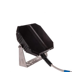
La station LNS peut être connectée à des caméras IP mais également à des webcams. Ainsi, elle réalise des photos et vidéos non seulement à pas de temps fixe mais surtout sur évènements afin, en cas d’alerte, de pouvoir visualiser la réalité de l’évènement.
Les stations LNS et AQUA-CJ sont des stations multi-protocole. La collecte des données peut être réalisée de multiples façons.
A distance :
Les mesures peuvent être envoyées en « mode push » par ftp ou http comme pièce jointe d’un simple mail.
La station LNS gère également le protocole PLQ 2000, elle peut donc être collectée par la plupart des superviseurs du marché et garantie une totale interopérabilité avec les services déconcentrés de l’état (SPC, DREAL, DDTM…).
Un simple navigateur web permet l’accès aux données et le paramétrage de la totalité de la station LNS. Le PC ou la tablette peuvent indifféremment être connectés par un câble USB ou en Wifi.
L’écran couleur graphique présent en façade de la station permet de consulter l’ensemble des informations, de réaliser des graphiques et le clavier 22 touches permet un paramétrage aisé.
Les données peuvent également être déchargées directement sur une clef USB.
Réalisations
Mise à jour AQUA-CJ V1.2.14 du 7 mai 2025
Nos produits
Si vous souhaitez plus d’informations concernant un produit ou sur nos activités n’hésitez pas à nous contacter.
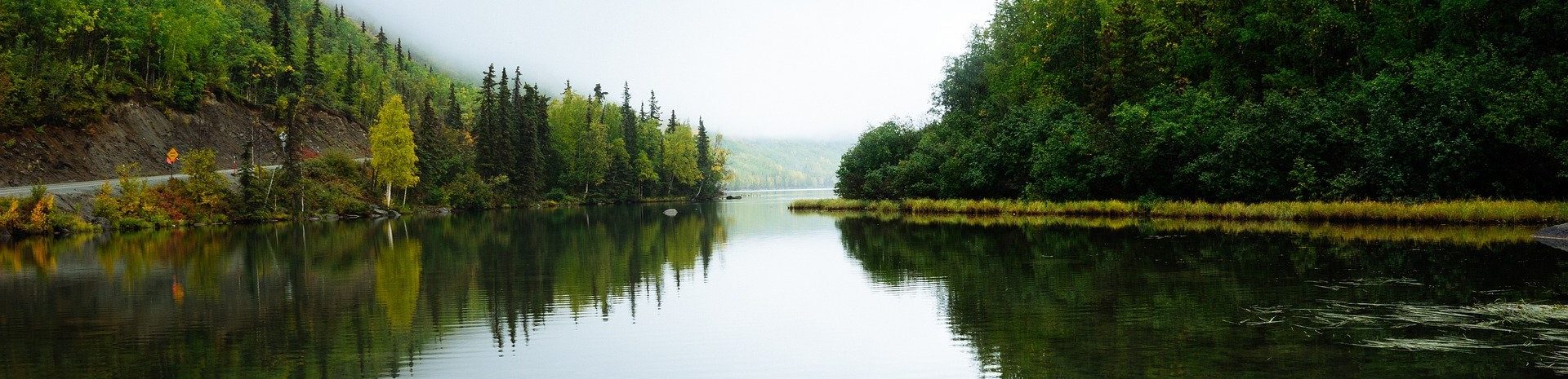
Découvrez notre système de surveillance de L’Eau en milieu naturel
Paratronic
Zone Industrielle Rue des genêts
01600 REYRIEUX
T : +33(0) 4 74 00 12 70
F : +33(0) 4 74 00 02 42
Suivez-nous sur les réseaux sociaux
![]()
![]()
Contactez-nous
Vous souhaitez en savoir plus sur nos produits ou services ? Appelez-nous directement au
+33(0) 4 74 00 12 70 ou écrivez-nous.