Surveillance des eaux en milieu naturel
Le Département de la Côte-d’Or se caractérise par sa situation géographique particulière en tête de trois grands bassins hydrographiques : Loire-Bretagne, Seine-Normandie et Rhône-Méditerranée.
Ces trois grands bassins hydrographiques sont constitués de :
Le Département réalise un suivi qualitatif et quantitatif des eaux souterraines et superficielles. Ce réseau patrimonial, débuté en 1994, permet d’affiner la connaissance de l’état des ressources en eaux et des milieux aquatiques.
Aujourd’hui le réseau comporte plus de 200 points de suivi, dont 170 pour le suivi qualitatif et 30 pour le suivi quantitatif. Ces suivis sont subventionnés et font l’objet de convention de partenariat avec les Agences de l’Eau.
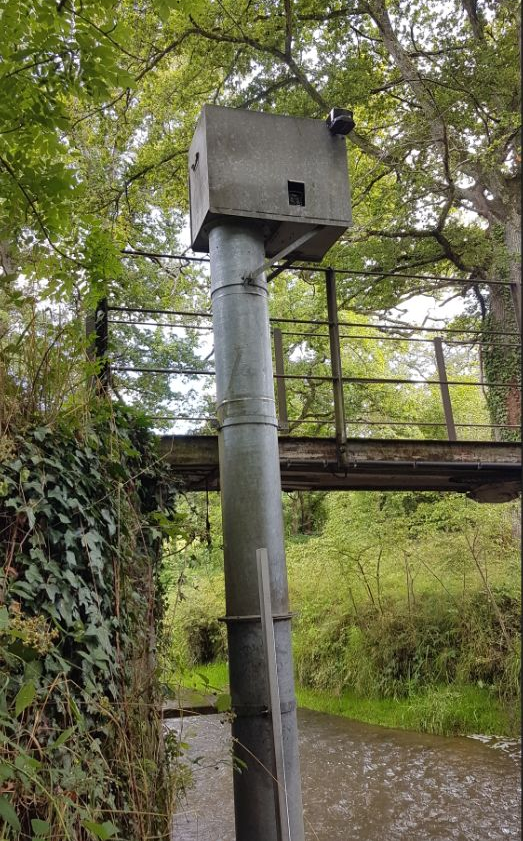
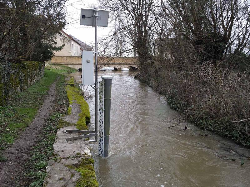
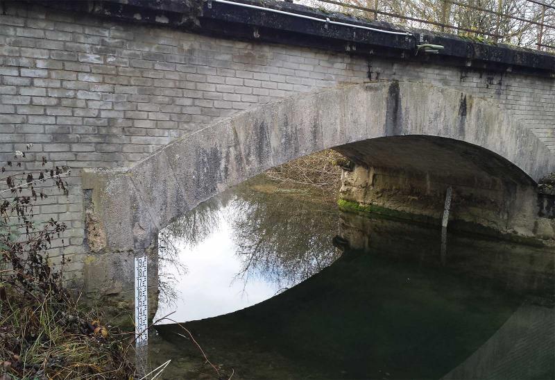
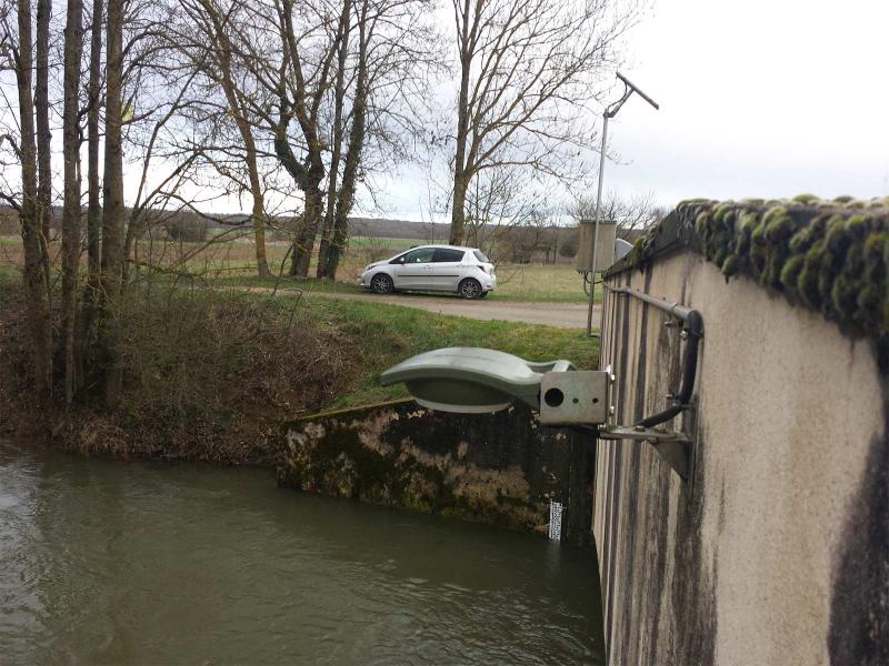
Le réseau quantitatif est constitué de 17 piézomètres mesurant les niveaux des principaux aquifères et de 13 stations hydrométriques. Il s’agit principalement d’évaluer les débits des cours d’eau et les niveaux des nappes.
Les données sont enregistrées tout au long de l’année, à des pas de temps variables, allant de quelques minutes à une heure selon la configuration du point et les besoins de l’étude.
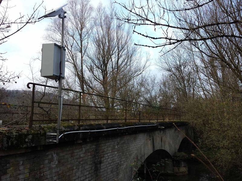
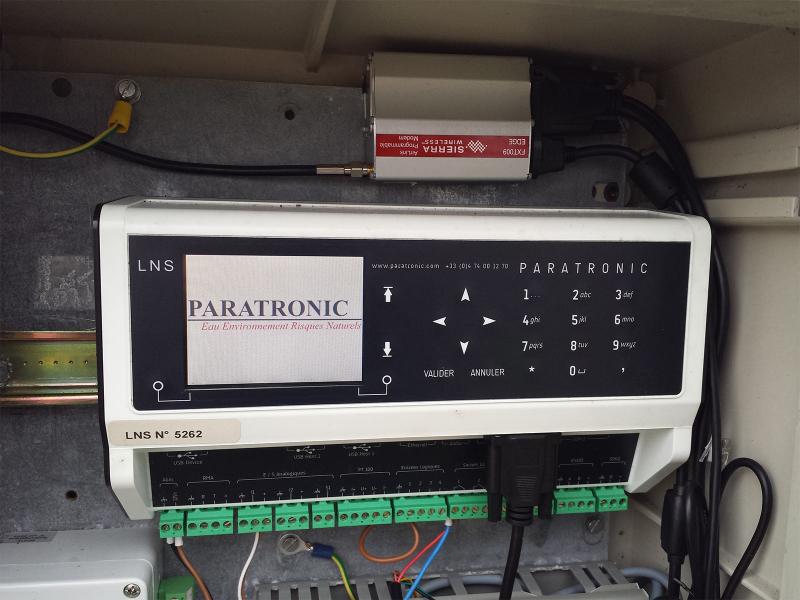
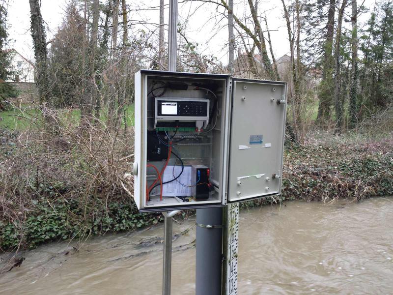
Les données sont relevées au cours de visites régulières (toutes les 4 à 6 semaines) ou télétransmises directement. Les stations LNS de PARATRONIC, équipées de capteurs piézométriques SNA ou de radars CR420, ont étés choisies pour assurer l’acquisition des mesures de niveau des cours d’eau et le rapatriement de données (modem GSM/GPRS/3G).
Les suivis sont sous-traités à un prestataire extérieur (M2E) pour les eaux superficielles et au BRGM pour les eaux souterraines.
Les données collectées sont vérifiées, formatées et déposées dans les banques nationales de données : dans ADES pour les eaux souterraines et dans la BANQUE HYDRO pour les eaux superficielles.

AQUA-CJ station acquisition
Les stations d’acquisition LNS et maintenant AQUA-CJ, ont spécialement été développées afin de répondre à ce genre de problématique : surveillance des milieux naturels sensibles par capteurs, bancarisation et transmission des données, déclenchement d’alertes…
Article Sud Ouest Maine-e-Loire : Le SDIS 49 Inaugure deux nouvelles technologies, les caméras de détection des feux de forêts et une équipe de télépilotes de drones.
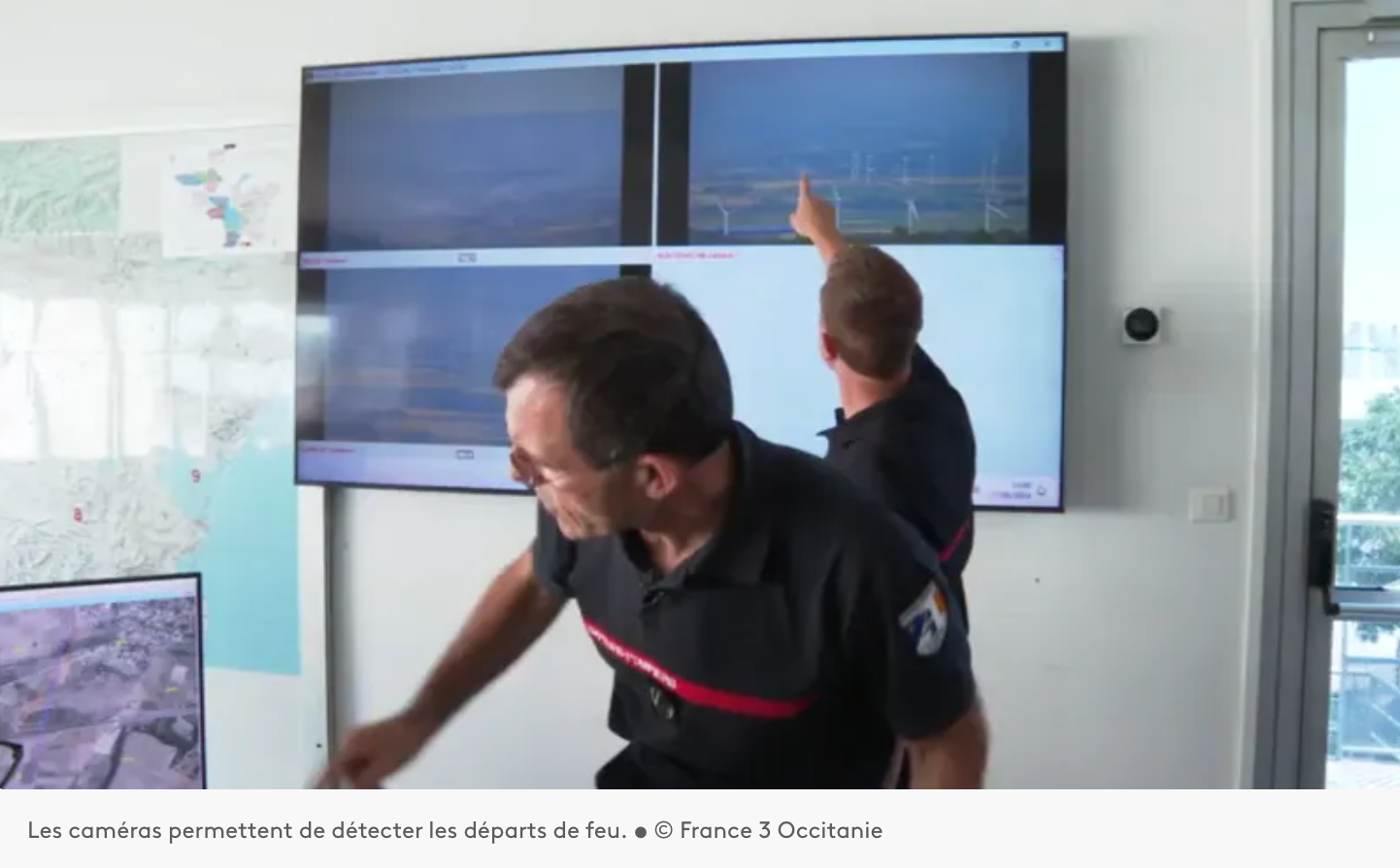
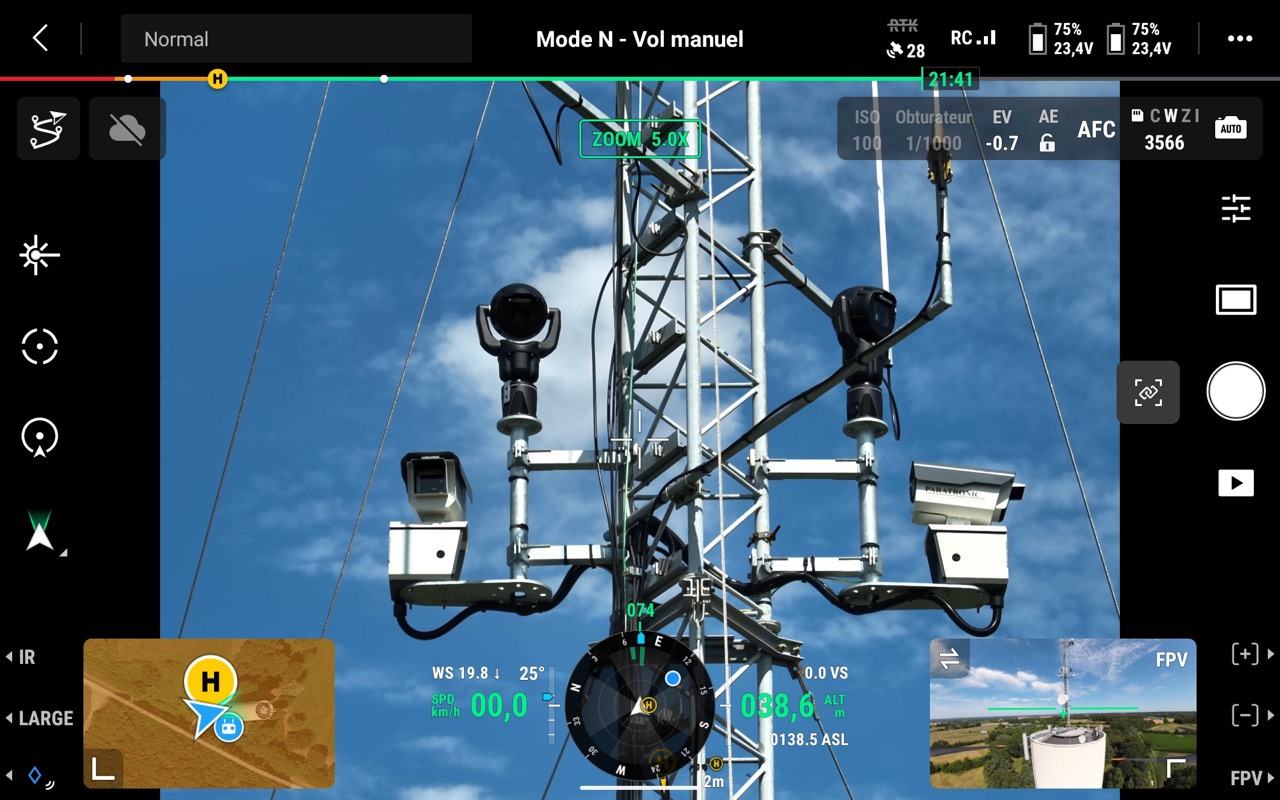
Installation d’un système d’Alerte, DEtection et Localisation des Incendies par caméras sur les auteurs du département de l’Aude 11.
Paratronic
Zone Industrielle Rue des genêts
01600 REYRIEUX
T : +33(0) 4 74 00 12 70
F : +33(0) 4 74 00 02 42
Suivez-nous sur les réseaux sociaux
![]()
![]()
Contactez-nous
Vous souhaitez en savoir plus sur nos produits ou services ? Appelez-nous directement au
+33(0) 4 74 00 12 70 ou écrivez-nous.