Surveillance des eaux en milieu naturel
Le Conservatoire d’Espaces Naturels de Corse (CEN Corse) est une association de protection de l’environnement depuis 1972. Il est membre de la fédération des Conservatoires d’Espaces Naturels. Au titre de la loi Grenelle II de 2010, un plan d’actions quinquennal, approuvé à l’unanimité par la CTC le 28 janvier 2016, définit les orientations stratégiques du CEN Corse pour 5 ans.
Les missions du CEN Corse sont : connaître, protéger, gérer, valoriser, accompagner. Les activités principales sont la protection et la gestion de sites, l’expertise scientifique et technique, l’animation territoriale, ainsi que la sensibilisation et l’éducation à l’environnement.
Le Conservatoire d’Espaces Naturels de Corse est gestionnaire des sites du golfe du Valinco (sud-ouest de la Corse) depuis 1992. En 2007, le CEN Corse engage un diagnostic écologique de l’ensemble de la plaine de Tavaria (embouchure du Rizzanese), dont le but est de caractériser la zone humide et de mieux comprendre son fonctionnement, avec le soutien des acteurs locaux et des partenaires (AERMC, DREAL, CdL, EDF, OEC).
Le CEN Corse conduit, depuis 2010, une étude du fonctionnement hydrologique des zones humides présentes dans la plaine de Tavaria. Ce dispositif a été défini en collaboration avec des experts, M. Gauthier (hydrogéologue du conseil scientifique du CEN Corse) et M. Esteves (hydrologue de l’Institut des Géosciences de l’Environnement de Grenoble).
Il est constitué aujourd’hui de 5 enregistreurs de niveaux d’eau (surface et souterrain) réglés sur un pas d’enregistrement de 15 minutes. Pour compléter les données hydrologiques, des observations complémentaires sont utilisées comme les données Météo-France, les débits du Rizzanese observés en amont par EDF et la DREAL Corse.
Malgré le dispositif en place, les données collectées présentaient une lacune sur des données précises sur le débit entrant dans la plaine. En effet, de nombreux affluents rejoignent le Rizzanese entre les stations en amont et l’entrée de la plaine.
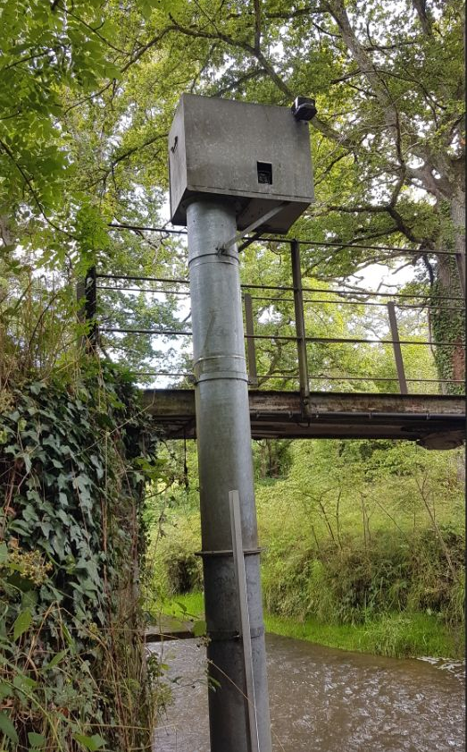
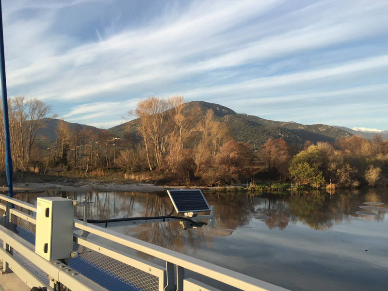
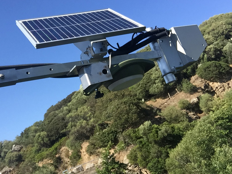
Le CEN Corse a donc contacté la société PARATRONIC pour équiper l’entrée de la plaine d’un système de mesures du débit entrant, depuis le pont d’Arena Bianca.
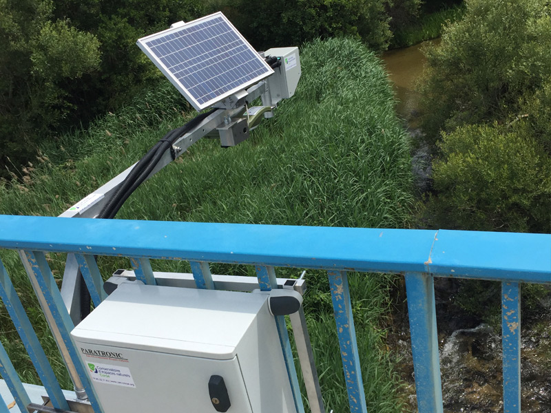
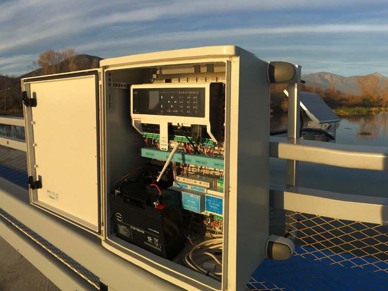
Grâce à une collaboration scientifique entre le CEN Corse et M. Esteves : un radar CRUZOE mesurant les hauteurs d’eau (portée 30 m, signal RS485) commandé par une centrale d’acquisition LNS solaire 3 voies (LNS GPRSSOL-3) de la société PARATRONIC et un radar de mesures de la vitesse de surface de l’eau de type Sommer RG-30, acquis auprès de la société AnHydre, ont été installés sur le pont routier.
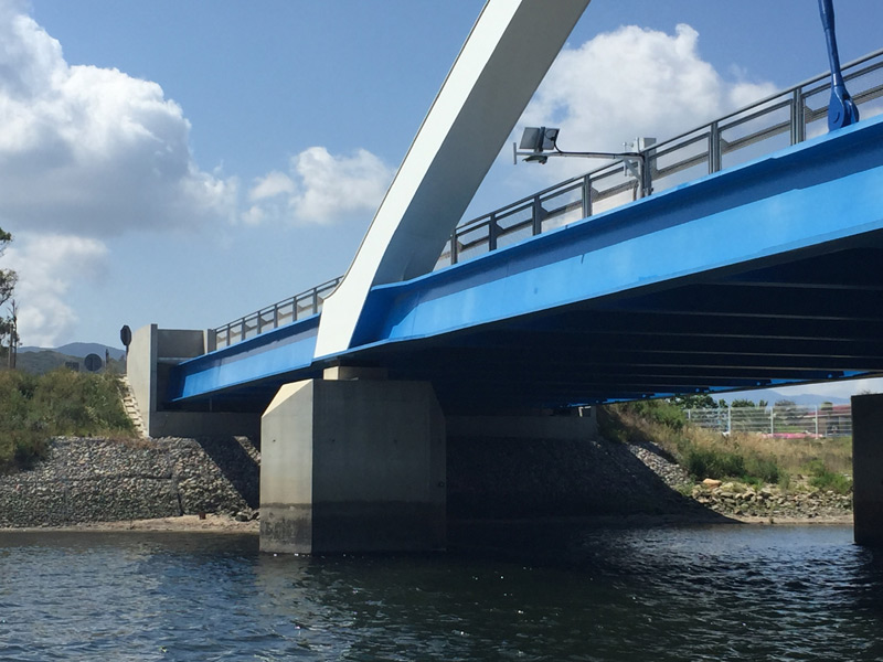
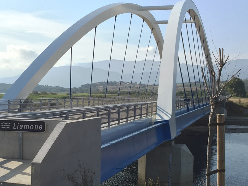
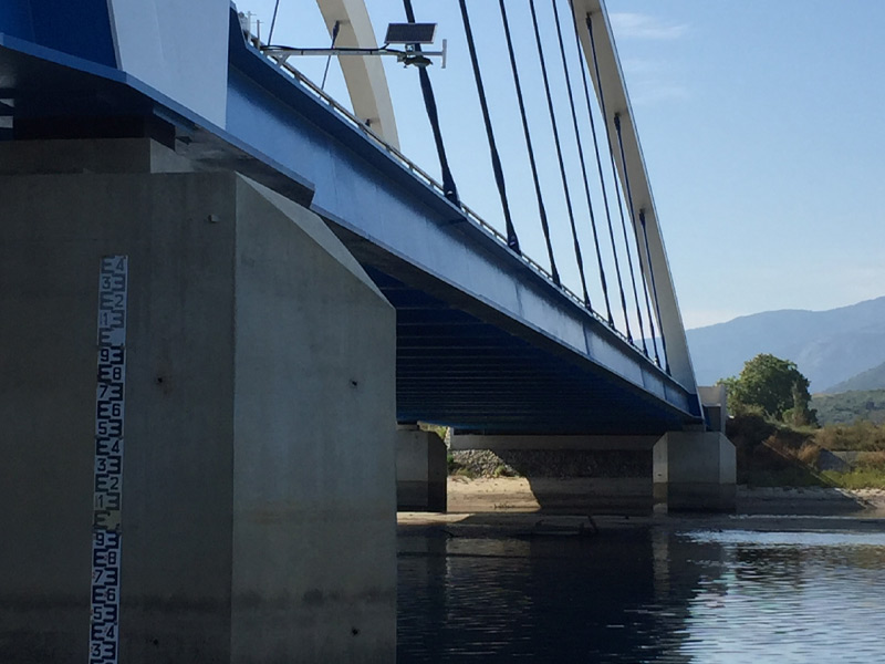
Le fonctionnement de la plaine de Tavaria semble être assez représentatif du fonctionnement des zones humides des secteurs d’embouchures des fleuves corses. Aussi, avec le soutien de l’AERMC, le CEN Corse a débuté l’étude du fonctionnement de la plaine de l’embouchure du Liamone, zone qui n’a connu aucune construction ou aménagement pouvant occasionner de perturbation majeure (ni barrage, ni aérodrome).
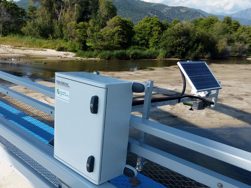
Le CEN Corse a donc également équipé le pont du Liamone d’un radar CRUZOE mesurant les hauteurs d’eau (portée 30 m signal RS485) commandé par une centrale d’acquisition LNS solaire 3 voies (LNS GPRSSOL-3) de la société PARATRONIC. Les coffrets sont protégés par des parafoudres (ex : PRO TAS30…)
Les objectifs du dispositif de mesures sont de :

AQUA-CJ station acquisition
Les stations d’acquisition LNS et maintenant AQUA-CJ, ont spécialement été développées afin de répondre à ce genre de problématique : surveillance des milieux naturels sensibles par capteurs, bancarisation et transmission des données, déclenchement d’alertes…
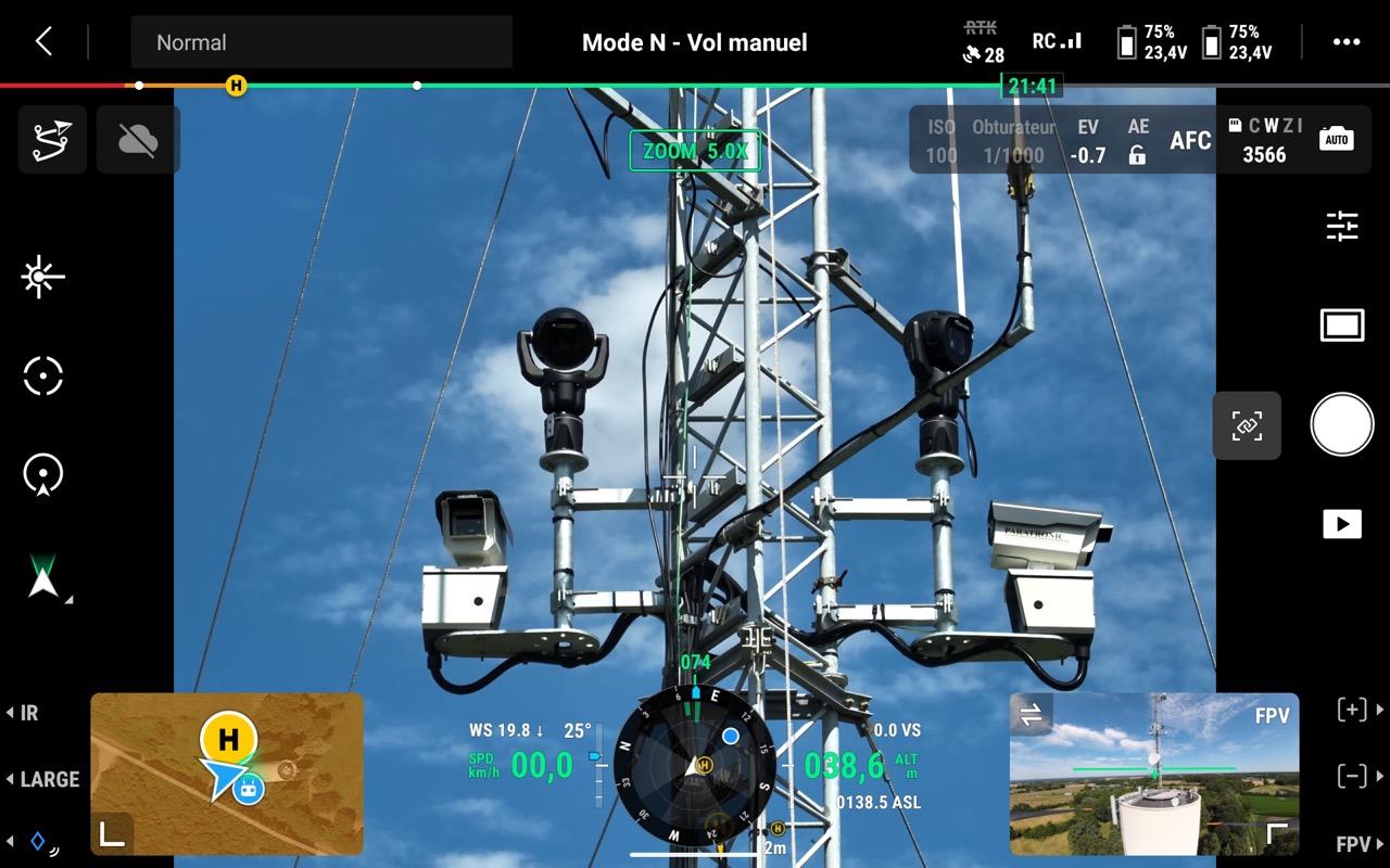
Article Sud Ouest Maine-e-Loire : Le SDIS 49 Inaugure deux nouvelles technologies, les caméras de détection des feux de forêts et une équipe de télépilotes de drones.
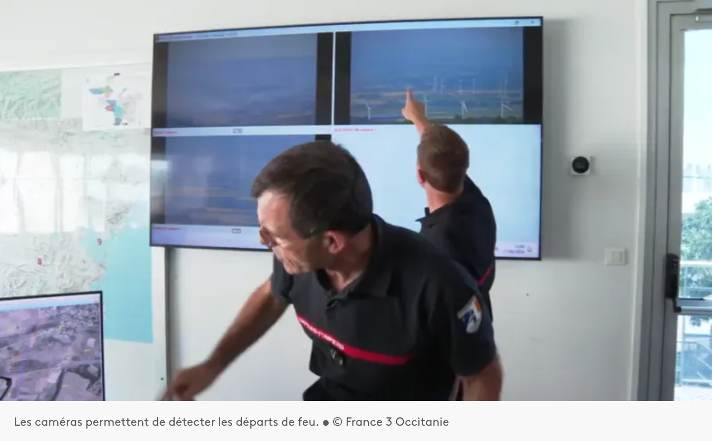
Installation d’un système d’Alerte, DEtection et Localisation des Incendies par caméras sur les auteurs du département de l’Aude 11.
Paratronic
Zone Industrielle Rue des genêts
01600 REYRIEUX
T : +33(0) 4 74 00 12 70
F : +33(0) 4 74 00 02 42
Suivez-nous sur les réseaux sociaux
![]()
![]()
Contactez-nous
Vous souhaitez en savoir plus sur nos produits ou services ? Appelez-nous directement au
+33(0) 4 74 00 12 70 ou écrivez-nous.