Surveillance des eaux en milieu naturel
Dans le cadre de ses compétences en matière de lutte contre les inondations, Caux Seine agglo est gestionnaire d’environ 160 ouvrages hydrauliques sur le territoire du SAGE (vallée du Commerce).
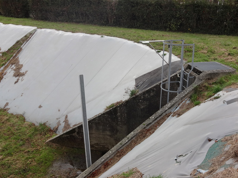
42 de ces ouvrages hydrauliques de lutte contre les inondations ont été équipés d’instruments de mesures du niveau de remplissage.
Ces ouvrages sont répartis sur tout le bassin versant, le plus éloigné étant situé à Graimbouville (76), et la majorité d’entre eux à proximité des villes centrales du territoire Caux Vallée de Seine.
Aucun de ces ouvrages ne possédait d’instruments de mesures avant 2017. Lors d’un épisode inondations, le seul moyen de connaître le niveau de remplissage des ouvrages en « temps réel » était de déployer des agents sur le terrain. C’est pour cette raison que Caux Seine Agglo a souhaité améliorer son dispositif de gestion de crise inondations, en installant un réseau d’instruments de mesures sur certains de ses ouvrages.
Ces installations forment un réseau permettant d’alerter et protéger les personnes et les biens en cas d’orages ou de précipitations intenses.
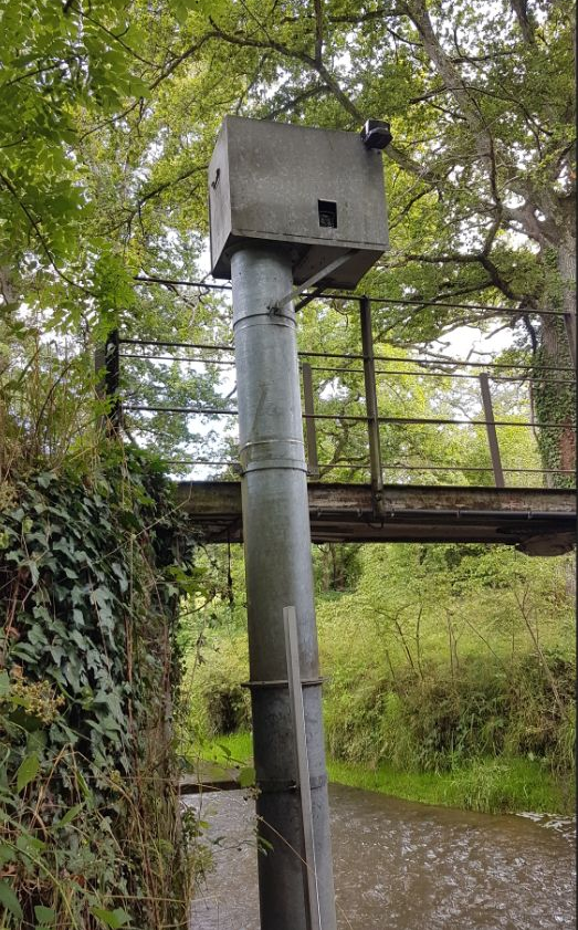
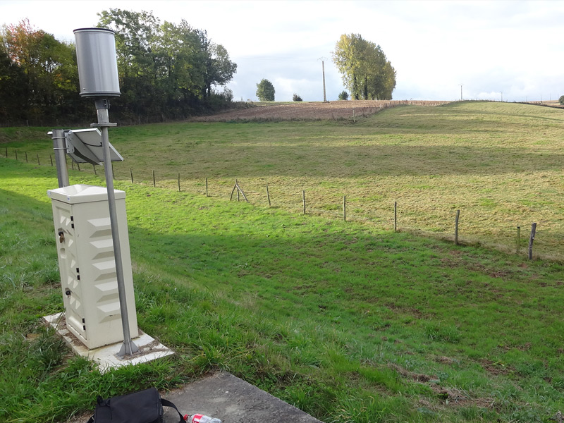
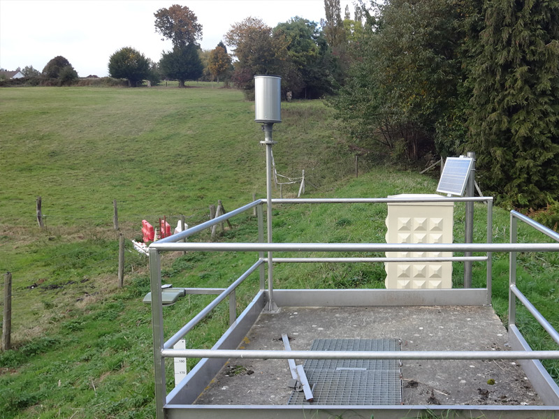
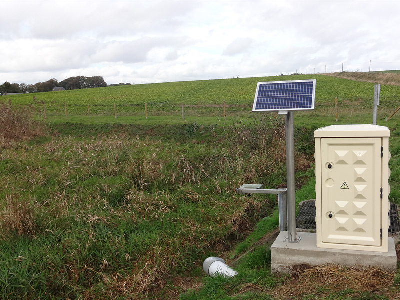
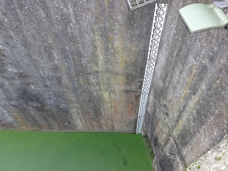
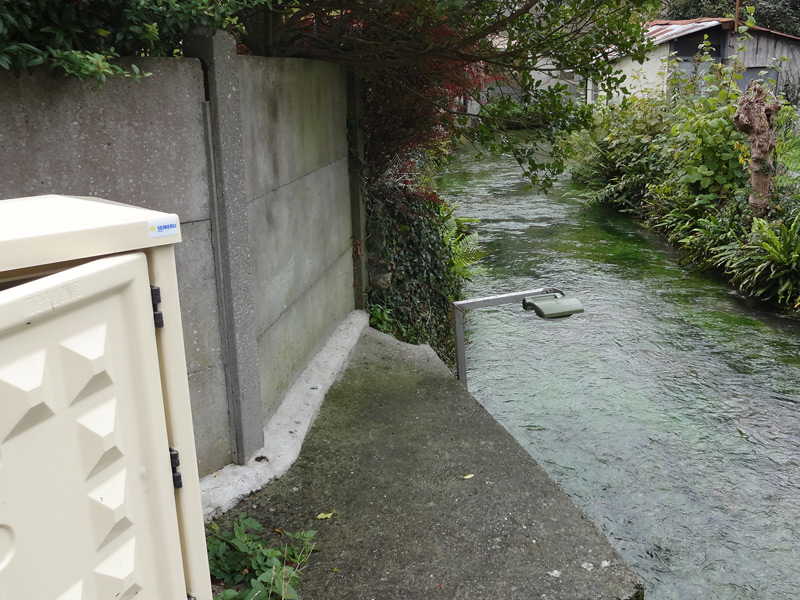
Les quarante-deux sites les plus sensibles (sur cent soixante ouvrages hydrauliques) ont été équipés de matériel permettant de réaliser des mesures de hauteurs d’eau (radar type CR 420-10) dans les bassins de rétention ainsi que les précipitations (pluviomètres type PLV400).
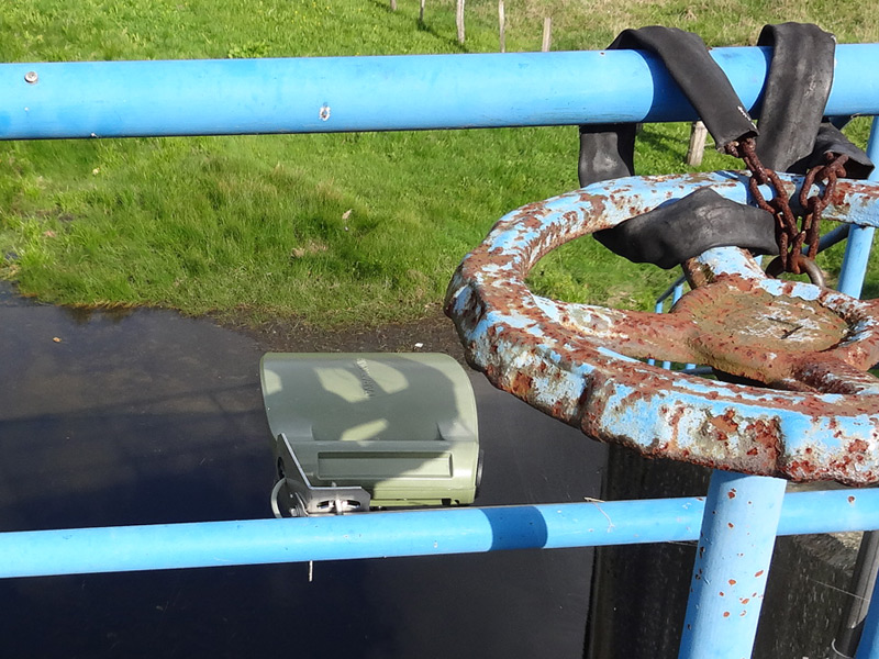
Ces différents capteurs sont reliés à des centrales d’acquisition faible consommation (LNS) qui sont alimentées soit par le réseau EDF, soit par panneaux solaires et systématiquement secourues par batteries.
Les stations gèrent les différentes informations issues des capteurs, les mémorisent et les transmettent au superviseur central (SIGMA II) par le biais du réseau GSM.
Les données recueillies sont exploitées sous forme de courbes, tableaux, graphiques… et permettent de capitaliser des informations afin de travailler sur l’anticipation des événements en élaborant différents scénarios de remplissages d’ouvrages, selon l’intensité et le lieu des précipitations.
La société SEMERU a réalisé l’installation des différents matériels qui ont été fournis par la société PARATRONIC.
Le projet d’instrumentation des ouvrages hydrauliques a été financé par la Caux Seine Agglo (423 500€ HT) et le Département de Seine-Maritime (181 500€ HT, soit 30% du coût total).
Le coût d’investissement global du projet revient à environ 605 000 € HT.
Le système permettra à la Caux Seine Agglo de gagner en efficacité lorsque des moyens humains doivent être déployés sur le terrain.
Le temps gagné à ne pas faire le relevé manuel des hauteurs d’eau pourra servir, par exemple, à réaliser des actions de sauvegarde durant la crise.
Le système permettra à la Caux Seine Agglo de gagner en efficacité lorsque des moyens humains doivent être déployés sur le terrain.
Le temps gagné à ne pas faire le relevé manuel des hauteurs d’eau pourra servir, par exemple, à réaliser des actions de sauvegarde durant la crise.

Les stations d’acquisition LNS ont spécialement été développées afin de répondre à ce genre de problématique : surveillance des milieux naturels sensibles par capteurs, bancarisation et transmission des données, déclenchement d’alertes…
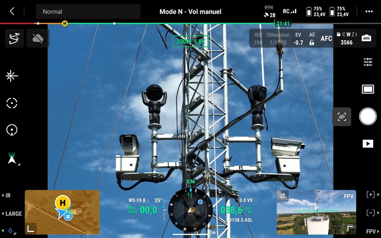
Article Sud Ouest Maine-e-Loire : Le SDIS 49 Inaugure deux nouvelles technologies, les caméras de détection des feux de forêts et une équipe de télépilotes de drones.
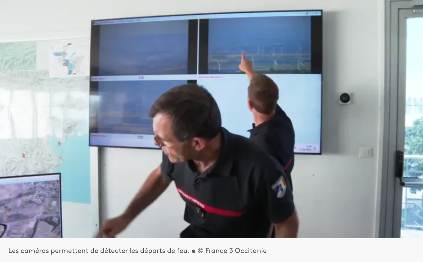
Installation d’un système d’Alerte, DEtection et Localisation des Incendies par caméras sur les auteurs du département de l’Aude 11.
Paratronic
Zone Industrielle Rue des genêts
01600 REYRIEUX
T : +33(0) 4 74 00 12 70
F : +33(0) 4 74 00 02 42
Suivez-nous sur les réseaux sociaux
![]()
![]()
Contactez-nous
Vous souhaitez en savoir plus sur nos produits ou services ? Appelez-nous directement au
+33(0) 4 74 00 12 70 ou écrivez-nous.